Rendered at 10:27:20 12/11/25

Free Shipping
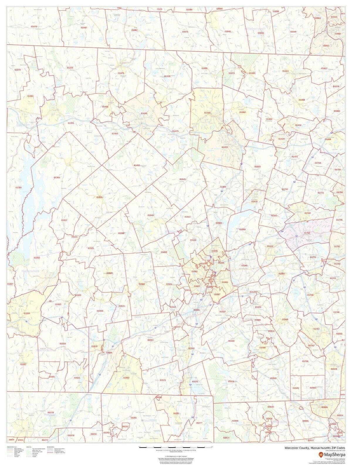
Worcester County, Massachusetts ZIP Codes Laminated Wall Map (MSH)
$193.05
(Buy a Up to 25% discount card for $25.00 first, and you will save $25.10 on this item and get up to 25% off future purchases for the next 3 months.
Unlock the discount with just a few clicks - start here)
$195.00
More info
Share & earn! Sign in, share this or any listing, and you’ll get commission when it sells.
Learn more

Shipping options
Estimated to arrive by Wed, Dec 31st.
Details
FREE via UPS Ground (1 to 5 business days) to United States
Return policy
Replacement product available within 30 days
Details
Purchase protection
Payment options
PayPal accepted
PayPal Credit accepted
Venmo accepted
PayPal, MasterCard, Visa, Discover, and American Express accepted
Maestro accepted
Amazon Pay accepted
Nuvei accepted
Item traits
| Category: | |
|---|---|
| Quantity Available: |
Only one in stock, order soon |
| Condition: |
New |
| Format: |
Wall Map |
| Topic: |
Maps |
Listing details
| Seller policies: | |
|---|---|
| Posted for sale: |
More than a week ago |
| Item number: |
741416943 |
Item description
Laminated Wall Maps By Rockford Publishing
Description
This map of Worcester County, Massachusetts shows ZIP code areas overlaid on a road map. Ideal for planning of deliveries, home ervices, sales territories, real estate and much more. Base map features include all roads with major roads and highways labelled; neighborhood names; railways; and high level land use such as parks and recreation areas, industrial areas and hospital campuses.
Page Size
36 x 48 in
Published
2019
Scale
1:85,000
-High quality double-sided lamination
-Hangs flat
-Brass hanging grommets
-Made in the USA!
-Latest Edition
Added to your wish list!
- Worcester County, Massachusetts ZIP Codes Laminated Wall Map (MSH)
- 1 in stock
- Handling time 10 days. Estimated delivery: Wed, Dec 31st
- Returns/refunds accepted
Get an item reminder
We'll email you a link to your item now and follow up with a single reminder (if you'd like one). That's it! No spam, no hassle.
Already have an account?
Log in and add this item to your wish list.